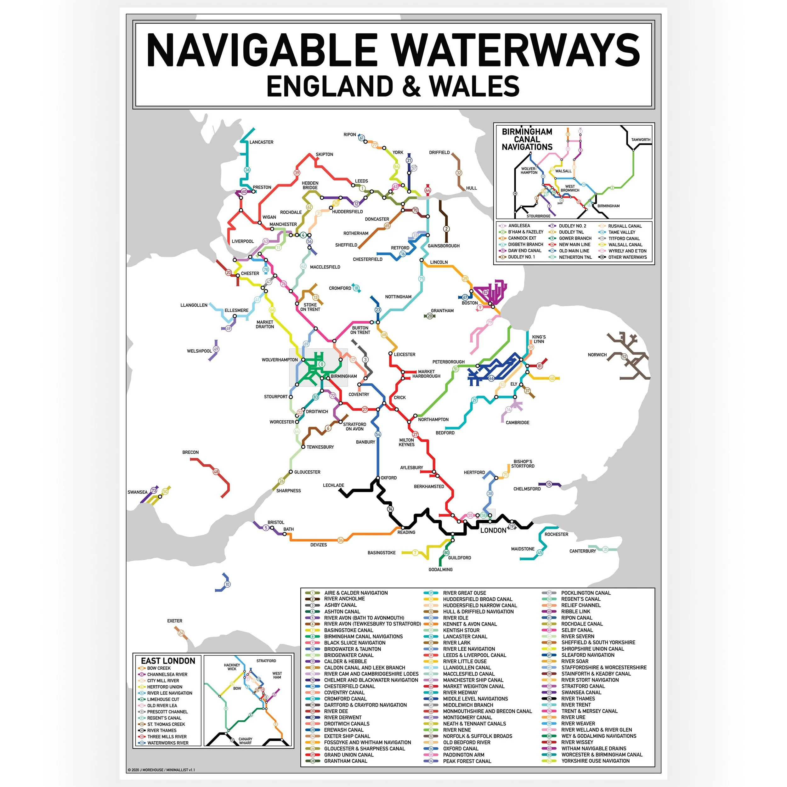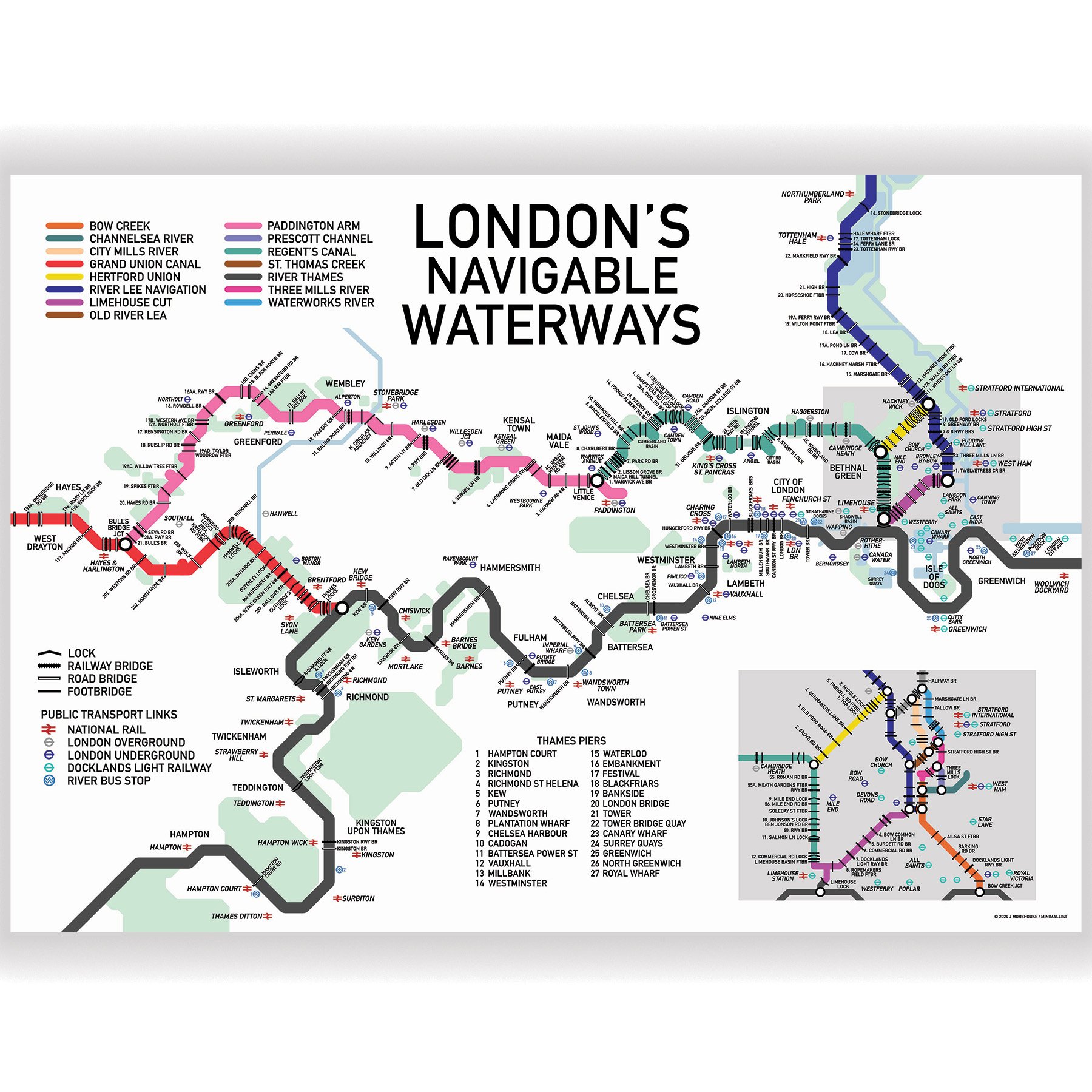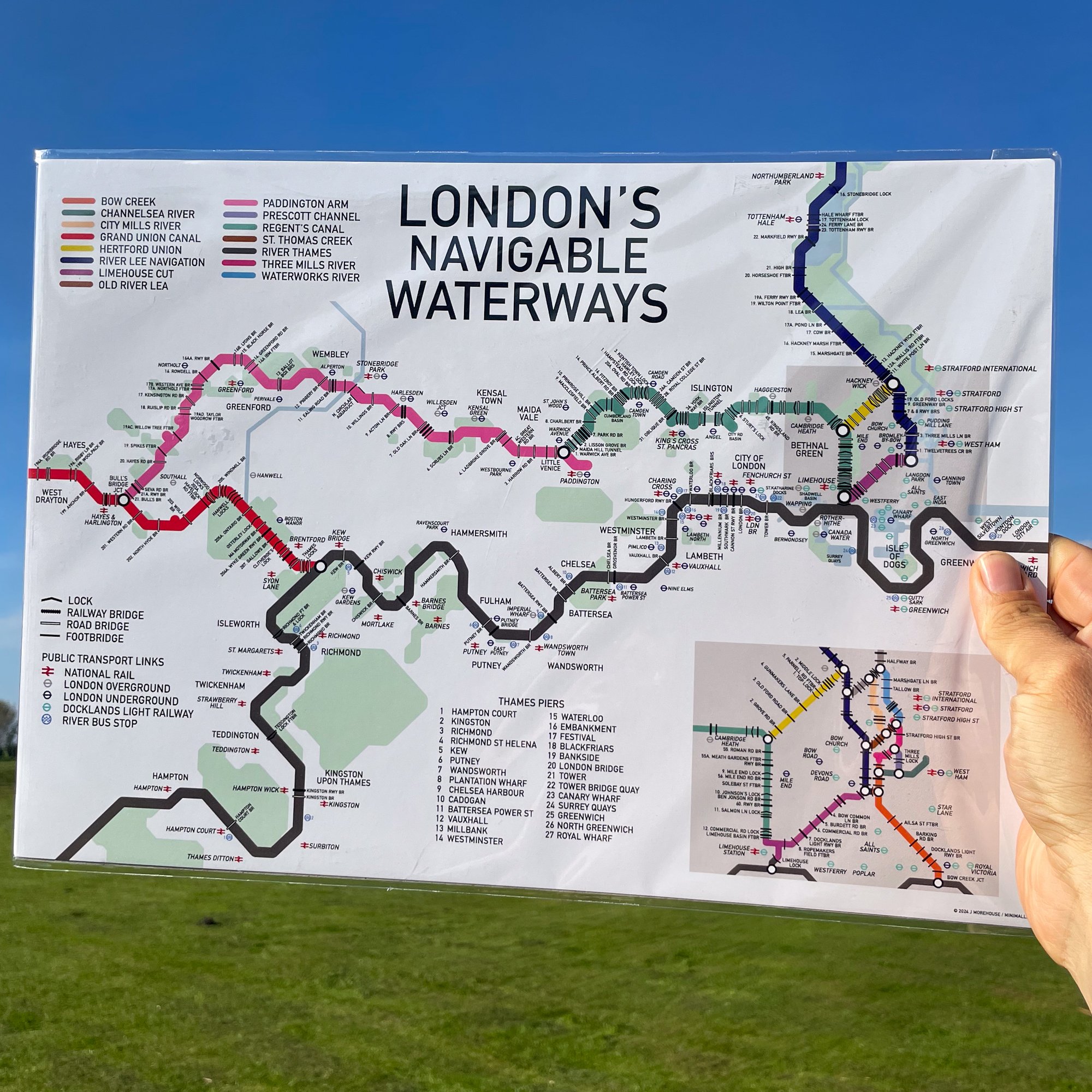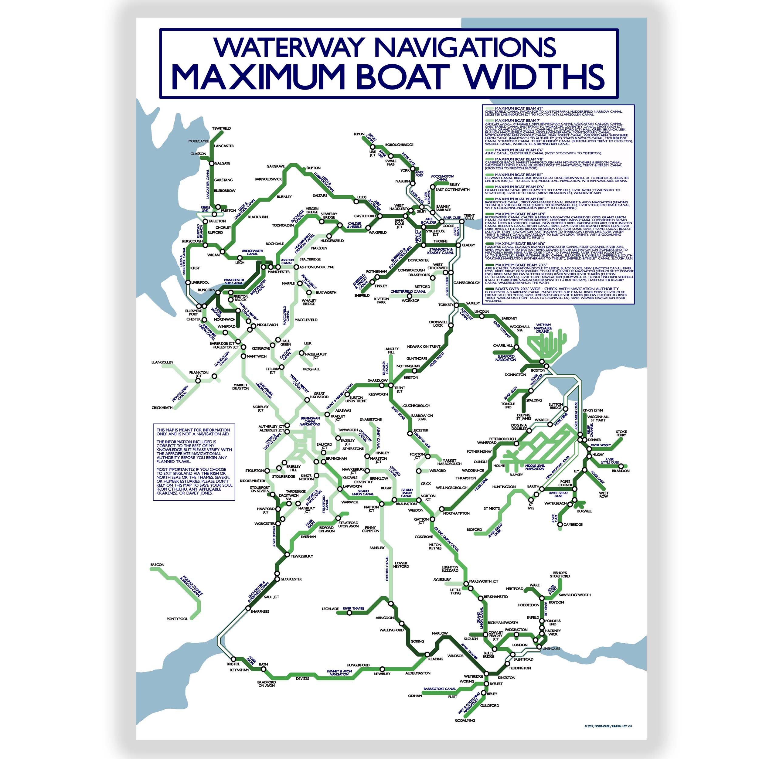


Navigable Waterways Map - Landscape - A3
This Inland Waterways Map in a landscape orientation showing the navigable waterways of England and Wales.
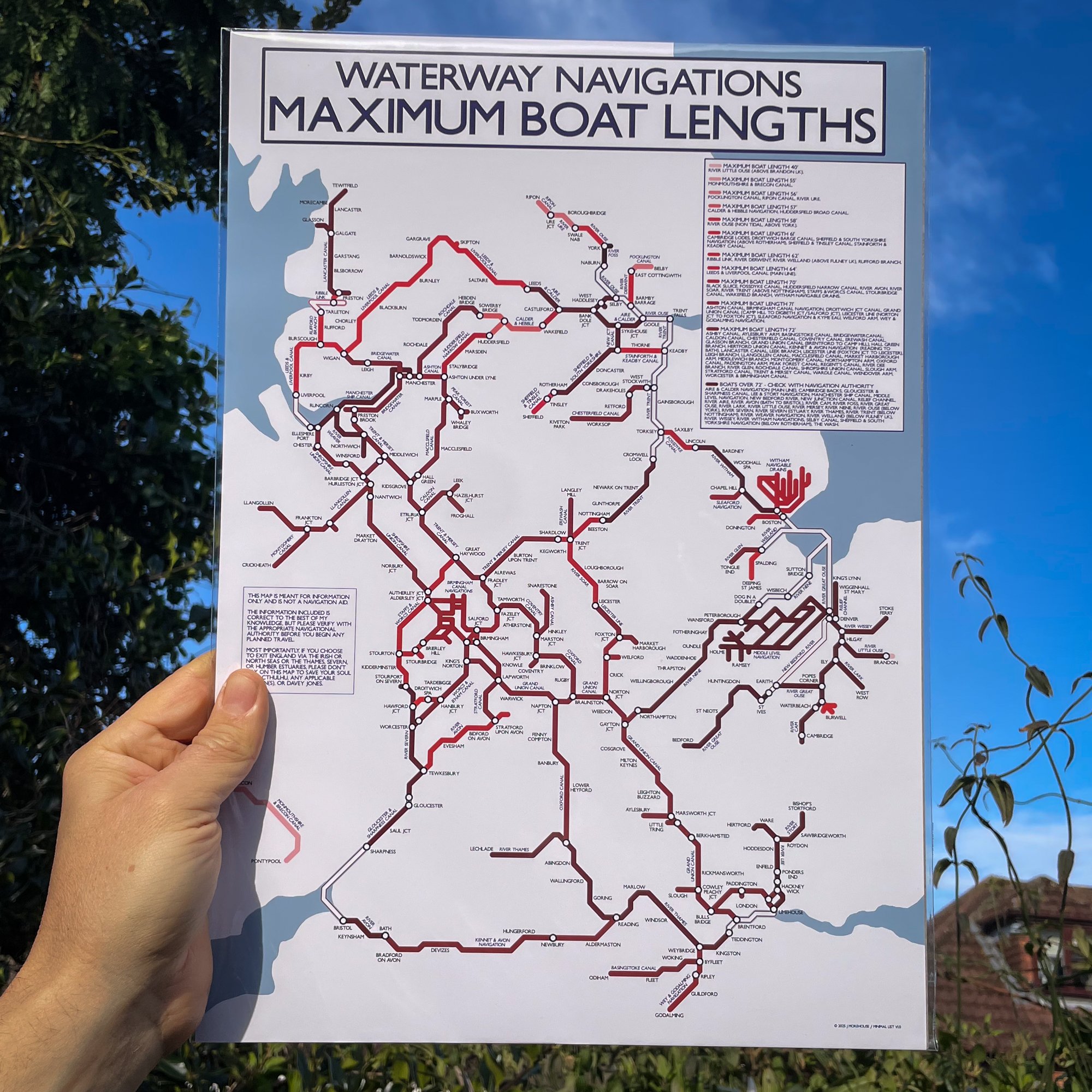
The map is a colour coded Tube-style guide to the UK inland waterways and highlights 81 navigable waterways.
The Map is marked with place location names for reference and there is a key on the left panel of the print listing each waterway by name.
There are zoomed in sections for the Birmingham Canal Network and the navigable waterways of East London.
This map does not include any disused waterways or those currently under restoration.
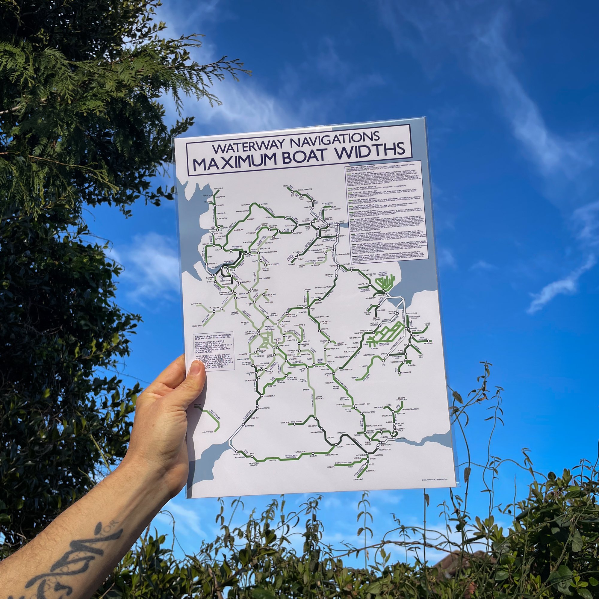
Print size - A3 - 420 x 297 mm
UK orders are despatched from our narrowboat home.
Orders outside the UK are printed on demand and shipped by a local print partner
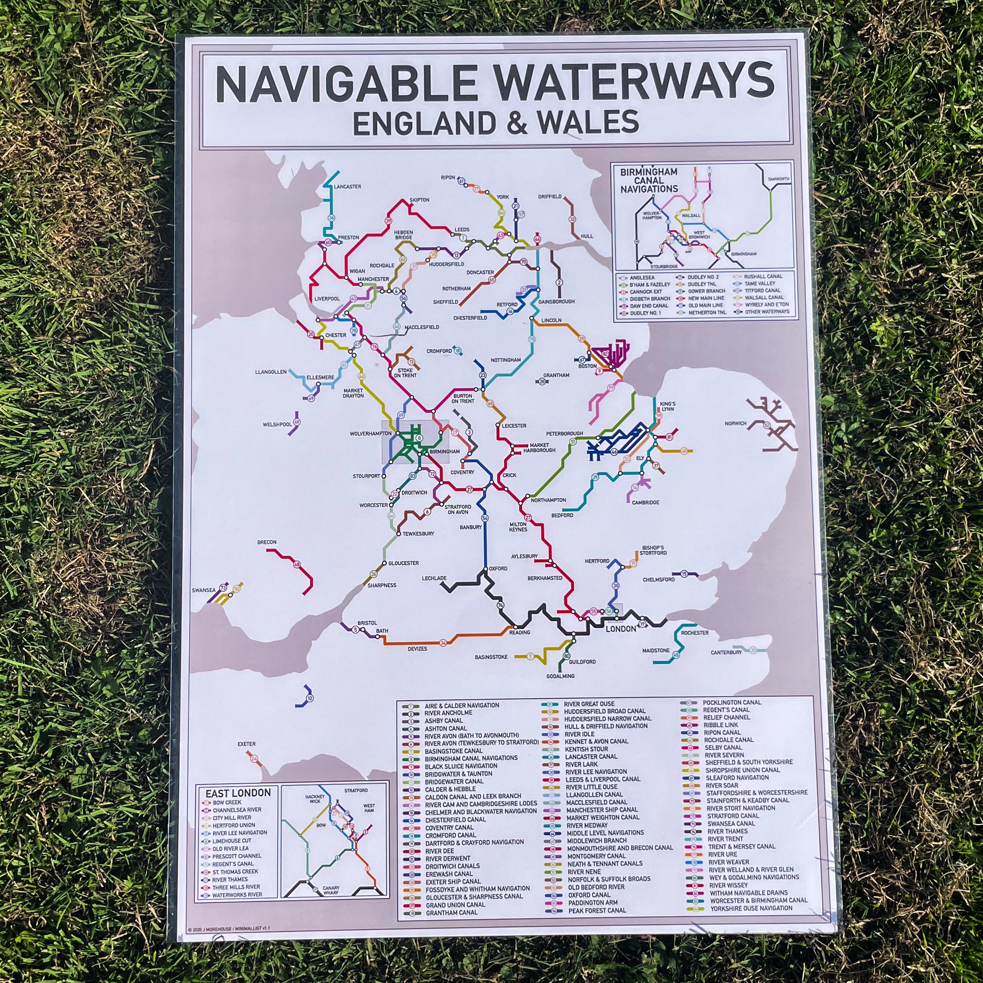
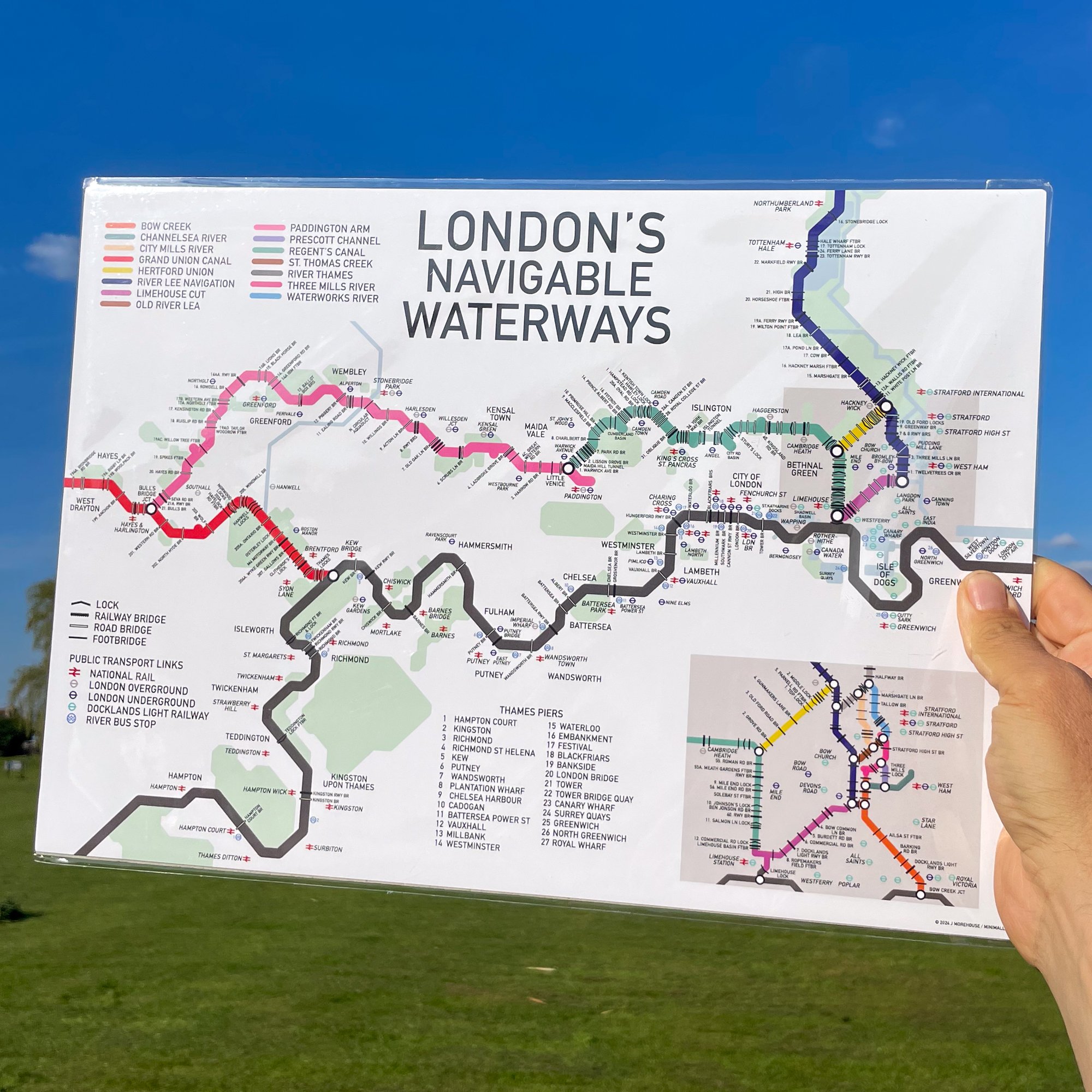
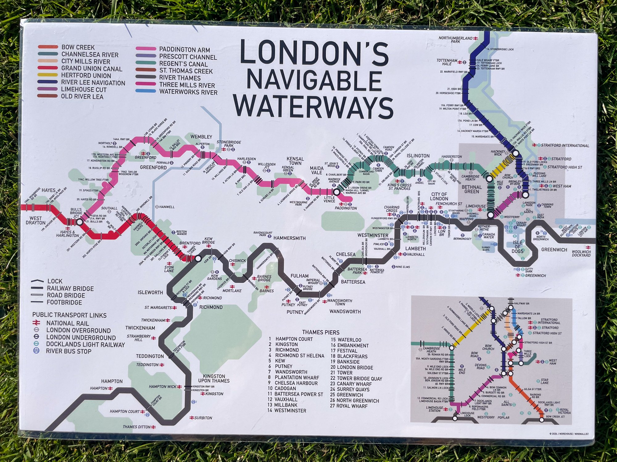
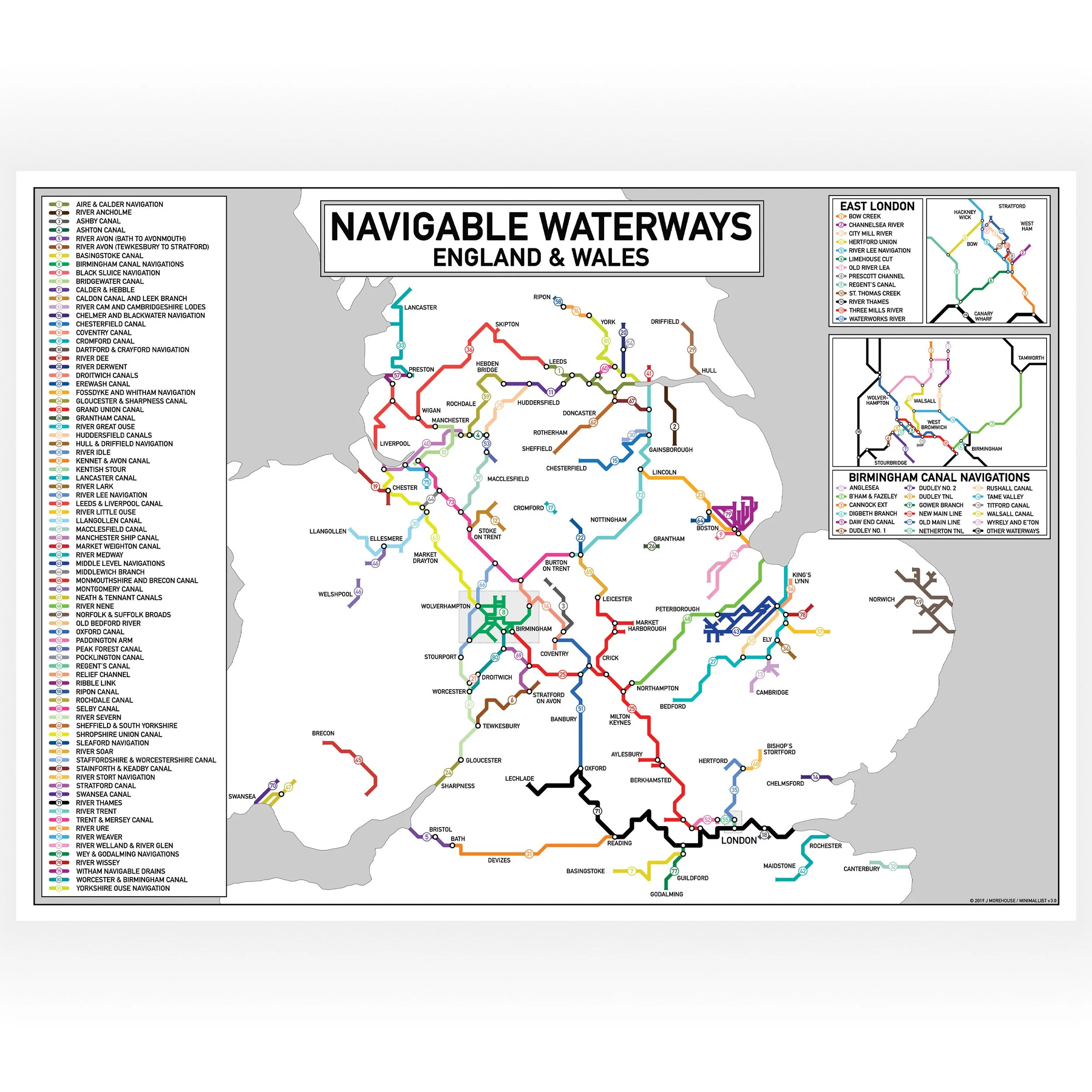
This Inland Waterways Map in a landscape orientation showing the navigable waterways of England and Wales.
The map is a colour coded Tube-style guide to the UK inland waterways and highlights 81 navigable waterways.
The Map is marked with place location names for reference and there is a key on the left panel of the print listing each waterway by name.
There are zoomed in sections for the Birmingham Canal Network and the navigable waterways of East London.
This map does not include any disused waterways or those currently under restoration.
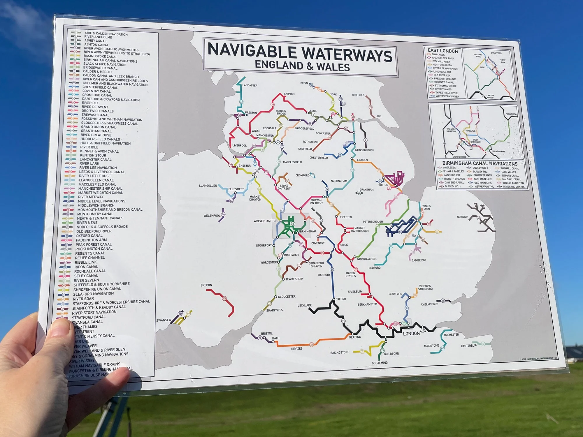
Print size - A3 - 420 x 297 mm
UK orders are despatched from our narrowboat home.
Orders outside the UK are printed on demand and shipped by a local print partner
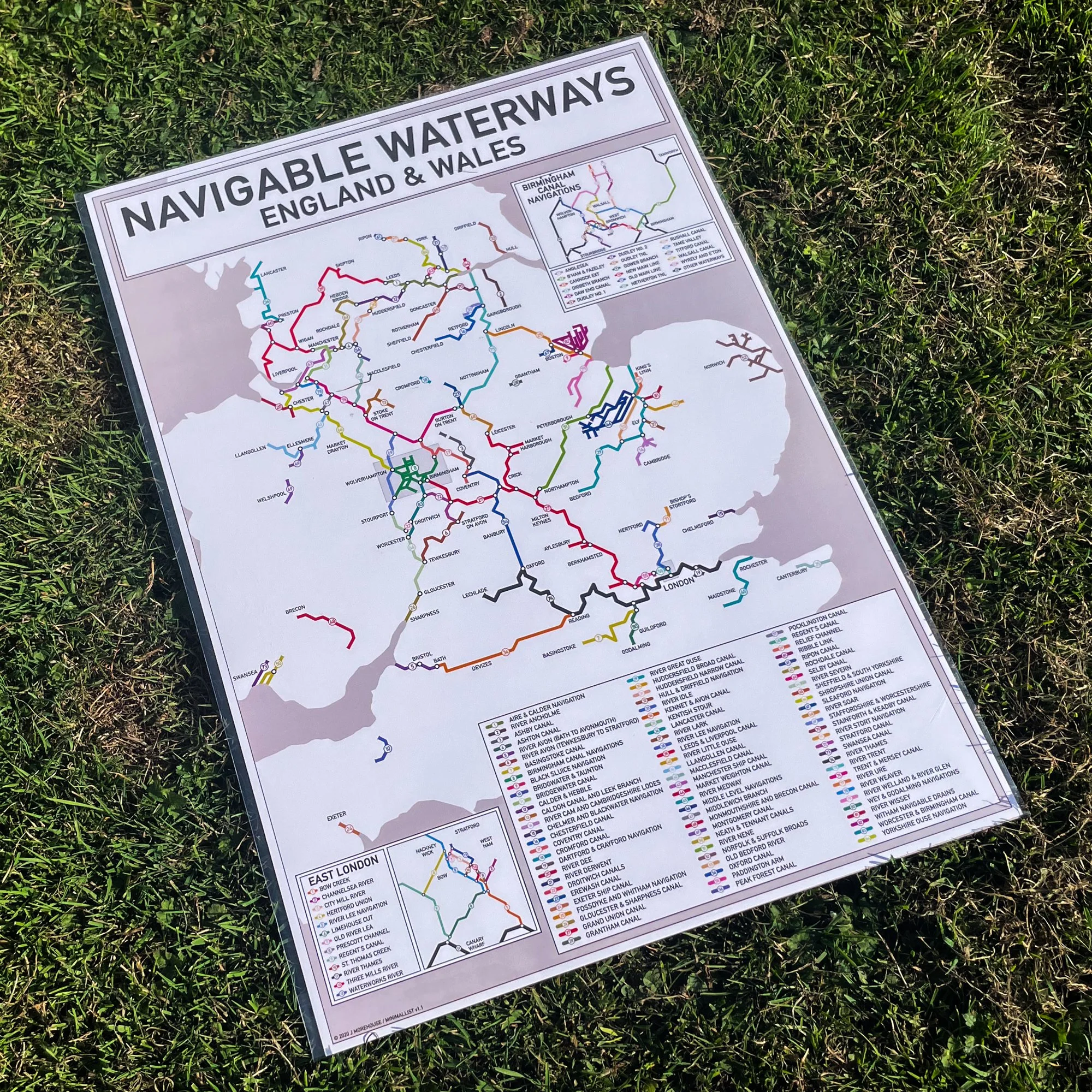
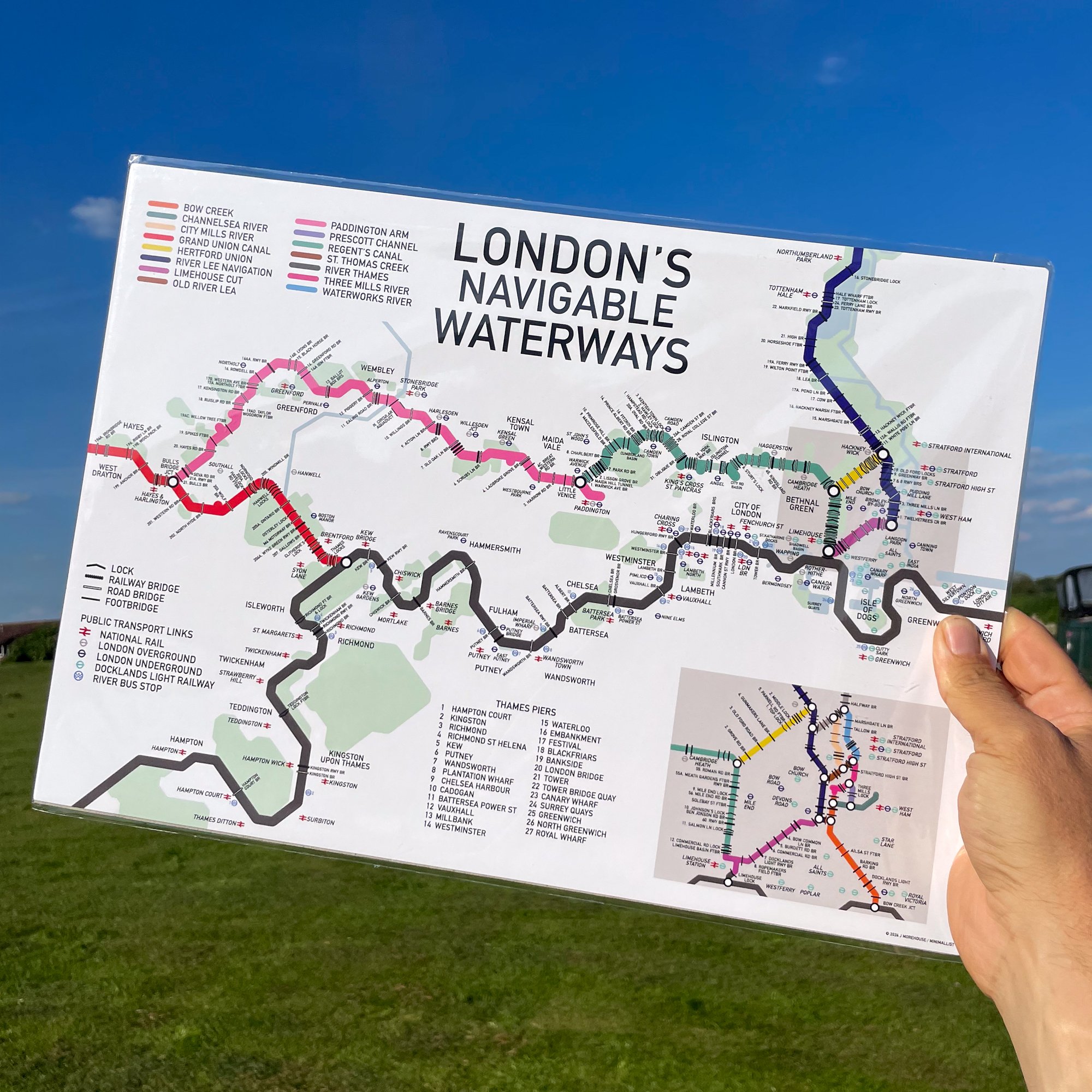
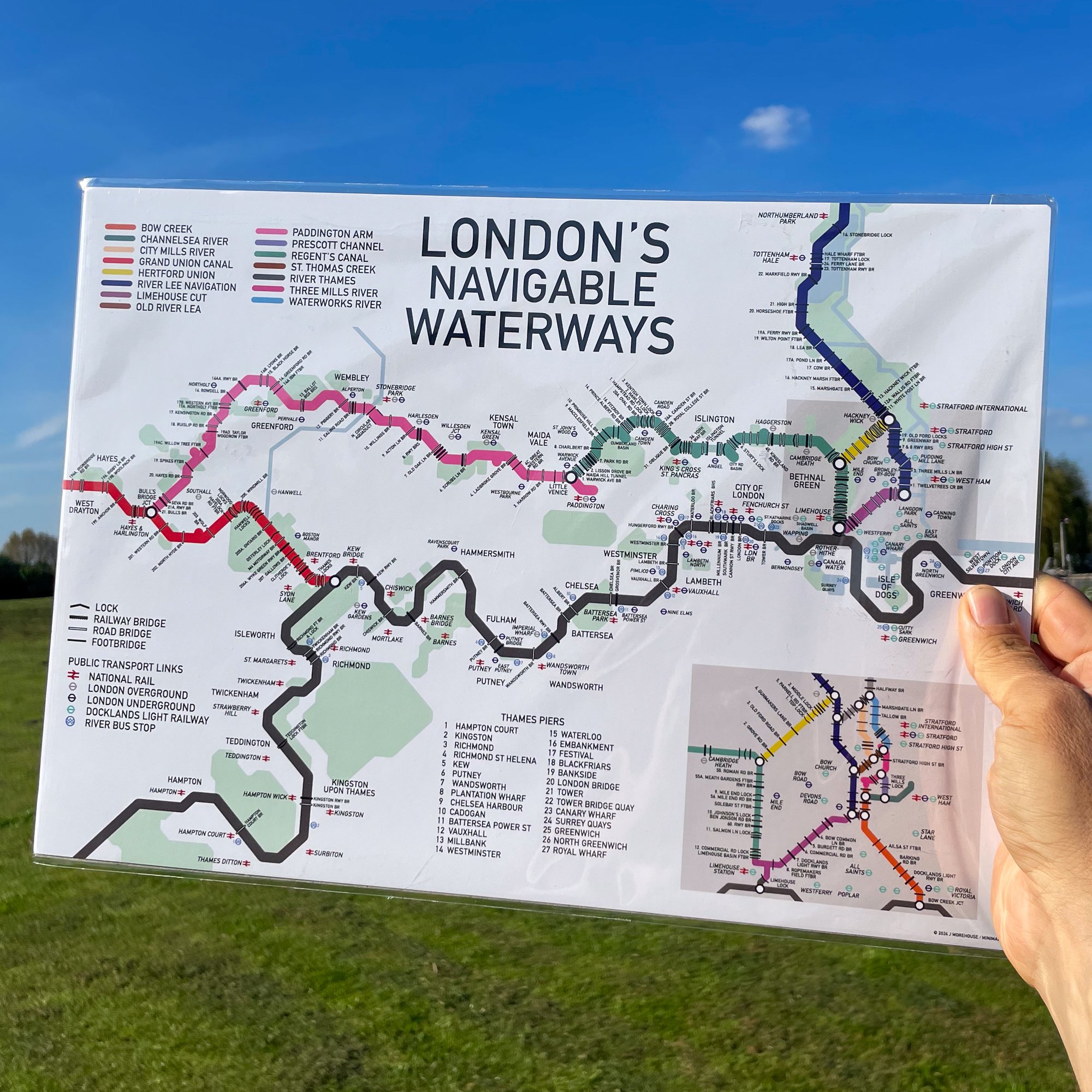
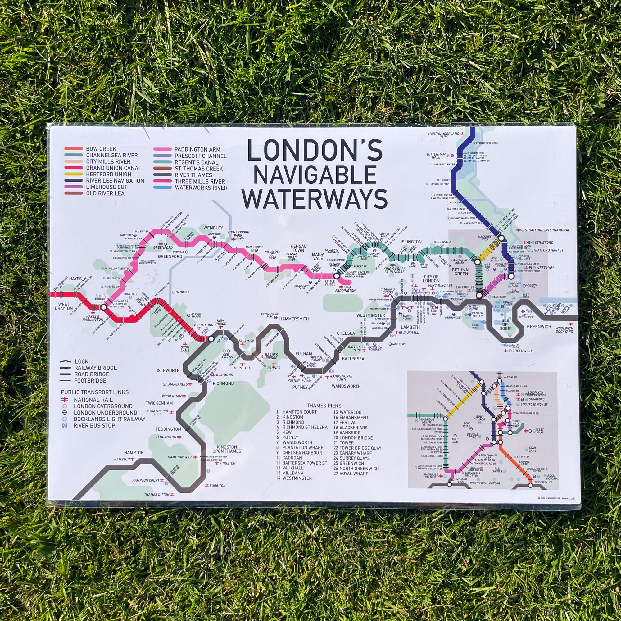
This Inland Waterways Map in a landscape orientation showing the navigable waterways of England and Wales.
The map is a colour coded Tube-style guide to the UK inland waterways and highlights 81 navigable waterways.
The Map is marked with place location names for reference and there is a key on the left panel of the print listing each waterway by name.
There are zoomed in sections for the Birmingham Canal Network and the navigable waterways of East London.
This map does not include any disused waterways or those currently under restoration.
Print size - A3 - 420 x 297 mm
UK orders are despatched from our narrowboat home.
Orders outside the UK are printed on demand and shipped by a local print partner